The Danube is the second largest river of Europe and the most important one in Central-East Europe. It’s hydrological catchment represents not only a geographic and geological unit in the Central-East area of Europe, but also an important factor in urban settlement-history and the formation of commercial routes since the Neolithic.
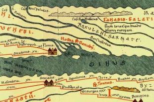
The first represetation of the Danube is obviously from the Roman times: both on maps and in allegoric forms (Trajan’s column, relief from Carnuntum, Tabula Peutingeriana, Notitia Dignitatum).
Here are some visual representations of the Danubian provinces and the Danubian area
Sources: Wikicommons, livius.org, http://www.univie.ac.at/limes, Igor Lipska (ed.), The Danube River Basin, Springer, 2015


